Topographic Surveys
Topographic surveys capture detailed land elevation data, helping plan construction, manage land resources, and assess landscape changes accurately and effectively.
High-Precision Geospatial Mapping with Aerial Imagery
Depending on what height the images are taken, accuracy may vary from 2 cm up to less than 10 cm. One of the products produced from these image is an orthophoto which is a geometrically corrected photograph with a uniform scale and can be used to measure true distances. Using UAV/MAV together with RTK GPS technology, we are able to provide you with very accurate geographical information.
Not only can these photos be used for normal viewing, but can be combined with other software such as ArcMap, ArcGIS, AutoCAD, ER Mapper, Model Maker or any other mapping/surveying packages similar to these. These photographs can be accurately overlaid with your CAD drawings as a background where additional scale correct information can be obtained.
Derived Products from Processed Images
The following products can be extracted after the images have been processed:
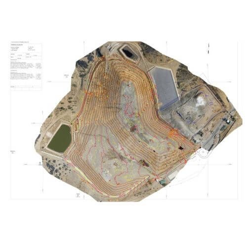
- Detailed topographic plan with all surveyed features required by client.
- An orthophoto which can be used as a back ground for the drawings and also to obtain additional scale correct information.
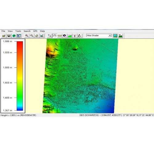
- A Point Cloud to be used for volume calculations (.csv).
- DEM(Digital Elevation Model) which is the same as a point cloud but reduced to a specified grid i.e. 10 m x 10 m.
- DWG/DXF
- TOT file (3D triangles)
- Other known formats such as .obj .3ds .wrl .dae .ply .stl .fbx .u3d .pdf and Google .kmz can also be exported.