Aerial Wildlife Surveys
Aerial wildlife surveys use aircraft and advanced technology to assess animal populations, habitat health, and conservation needs from above.
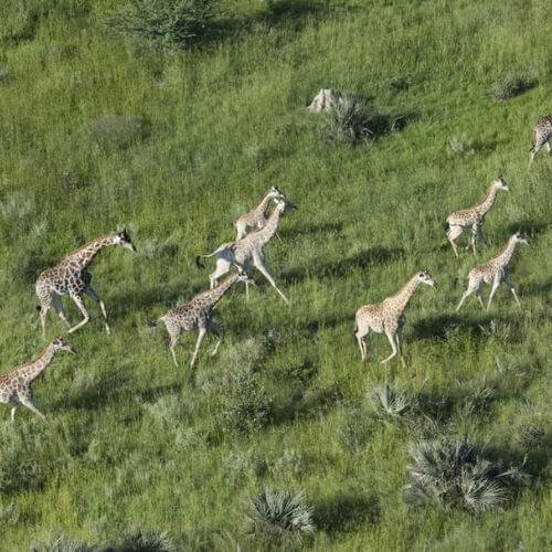
A New and Innovative Approach to Wildlife Surveys
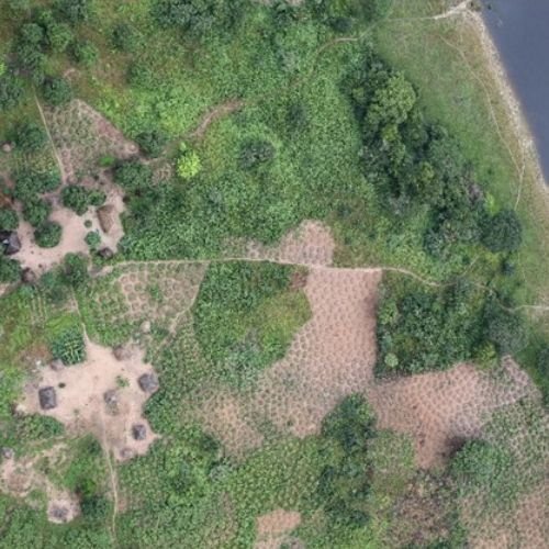
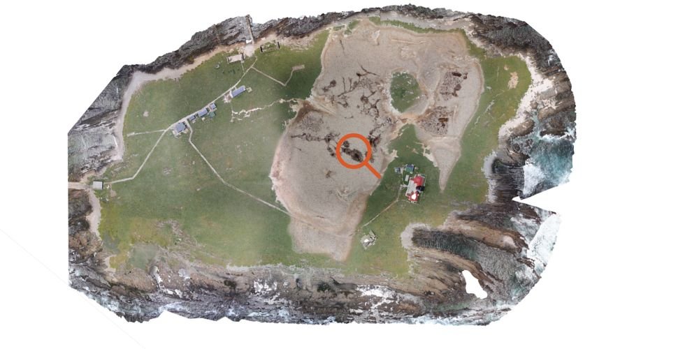
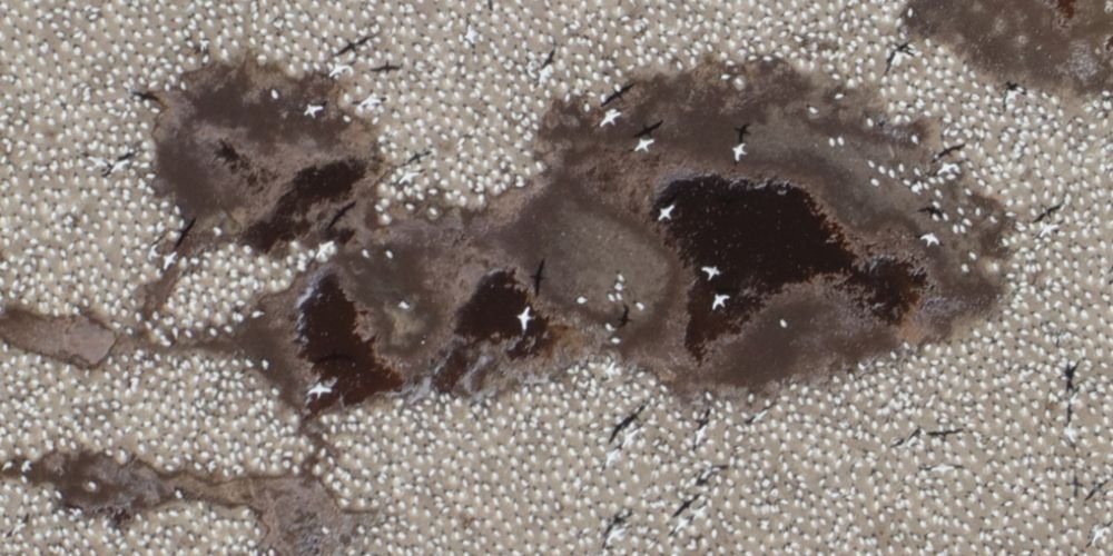
Bushskies Aviation, a young and dynamic Namibian company, has recently introduced a new concept in wildlife surveys: Aerial photography. The aircraft is equipped with high resolution cameras that photograph the terrain below the aircraft in strips about 500 m wide and with a resolution of less than 5 cm. This means that all wildlife can be identified to species level. We work with each client individually to make sure that all needs are fully met.
Discover the Advantages
Cost
Effective
Underpinned by up-to-date science & technology, and combined with the use of aircraft, Aerial Wildlife Surveys are a much more cost effective approach compared to conventional methods.
Historical
Comparisons
We offer the ability to be able to revisit photo images to check counts.
Data
Retention
We offer the ability to retain a permanent record of the count on electronic images.
Geo
Referenced
Geo-referenced information offers the ability for further research (e.g. habitat selection by different wildlife species).
Vegetation
Overview
We provide a detailed overview of vegetation, including woody plants.
Infrastructure
References
Having detailed, geo-referenced images of all infrastructure, e.g. buildings, roads, dams, etc. These images can be stitched together into one large farm photo.
Counting Wildlife
There are many ways to count wildlife and estimate their numbers. The most commonly used methods are fixed route ground counts using “distance” estimates, counting at waterholes in the dry season, doing spoor counts, and counting from an aircraft, either a fixed-wing using survey strips or a helicopter counting blocks. For some species – those with unique markings such as zebras and spotted cats – a photographic survey approach works well, making use of camera traps at water points and field photos.
The selection of a method depends on the habitat, species involved, size of area and cost. None of these methods give absolute numbers; they all provide estimates that are more-or-less accurate. Their real value comes from ongoing monitoring to determine trends over time.

Objectives of Wildlife Surveys
For farm-size areas of land, we recommend that 100% coverage is photographed. For very large areas, lesser coverage can be photographed and wildlife numbers calculated using statistical methods (e.g. for the Greater Fish River Canyon Landscape of about 1 million ha and the Iona National Park in Angola of about 1.5 million ha, an average photographic coverage of 40% was flown). There are many advantages to the wildlife aerial photographic survey method, including:
Objectives of Wildlife Surveys
1. Estimate the Numbers of wildlife of each species, i.e. How many? The typical reasons:
- To estimate stocking rates to manage the veld and grazing conditions and competition between species
- To set reasonable off-take quotas
- To determine the value of wildlife in the land
- To provide information to tourists


Objectives of Wildlife Surveys
2. Produce wildlife Distribution maps. Where are they? The typical reasons:
- For land-use planning and zonation
- To plan tourism routes
- To monitor veld condition in areas of high game concentrations
- To track distribution changes from year to year in response to rainfall or human factors such as water distribution, removal of fences, off-takes, etc
Objectives of wildlife surveys
3. Monitor Population Changes. Is wildlife increasing or decreasing, and is the distribution changing? The typical reasons:
- To monitor changes per species per year
- For management purposes, to assist the land owner or custodian to achieve their goals and objectives for wildlife management, biodiversity conservation and the protection of rare and vulnerable species