GIS Products
Our data capturing and processing capabilities allows for the creation of detailed products that can be used in decision making.
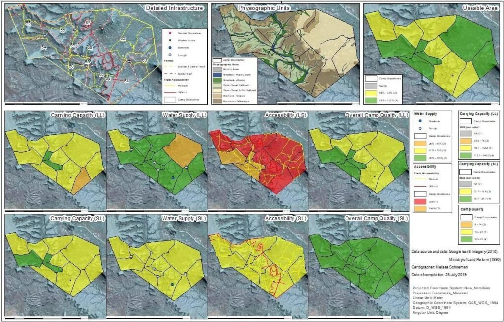
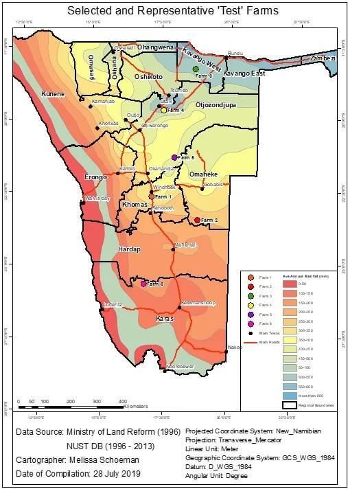
High Quality Thematic Maps
Elevation Data

3-D Visualisation & Representations

Complete Geo Databases

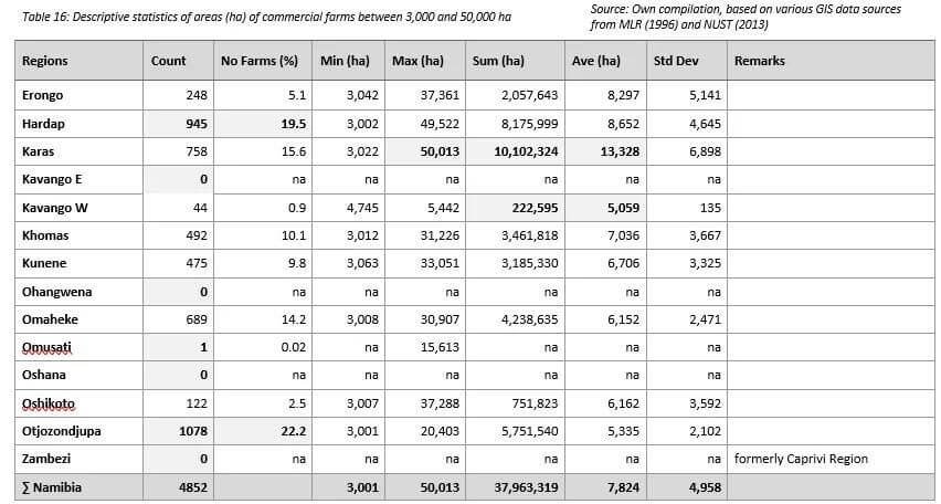
Descriptive Statistics